
Some places earn the word “otherworldly.” The Cumbre Vieja volcanic zone on the Spanish island of La Palma is one of them. My wife and I recently had the chance to hike through this raw and weirdly attractive landscape.
What Happened Here
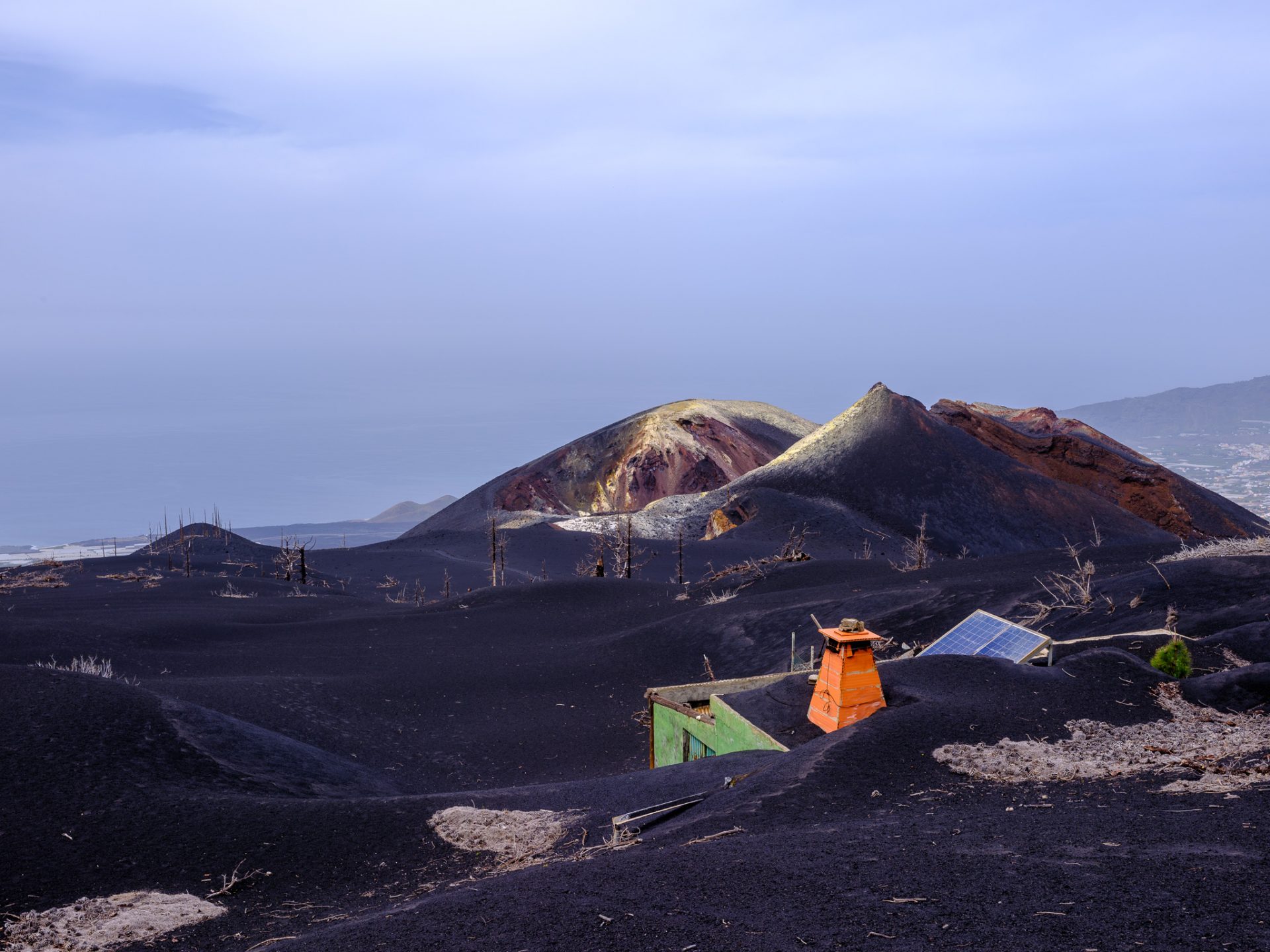
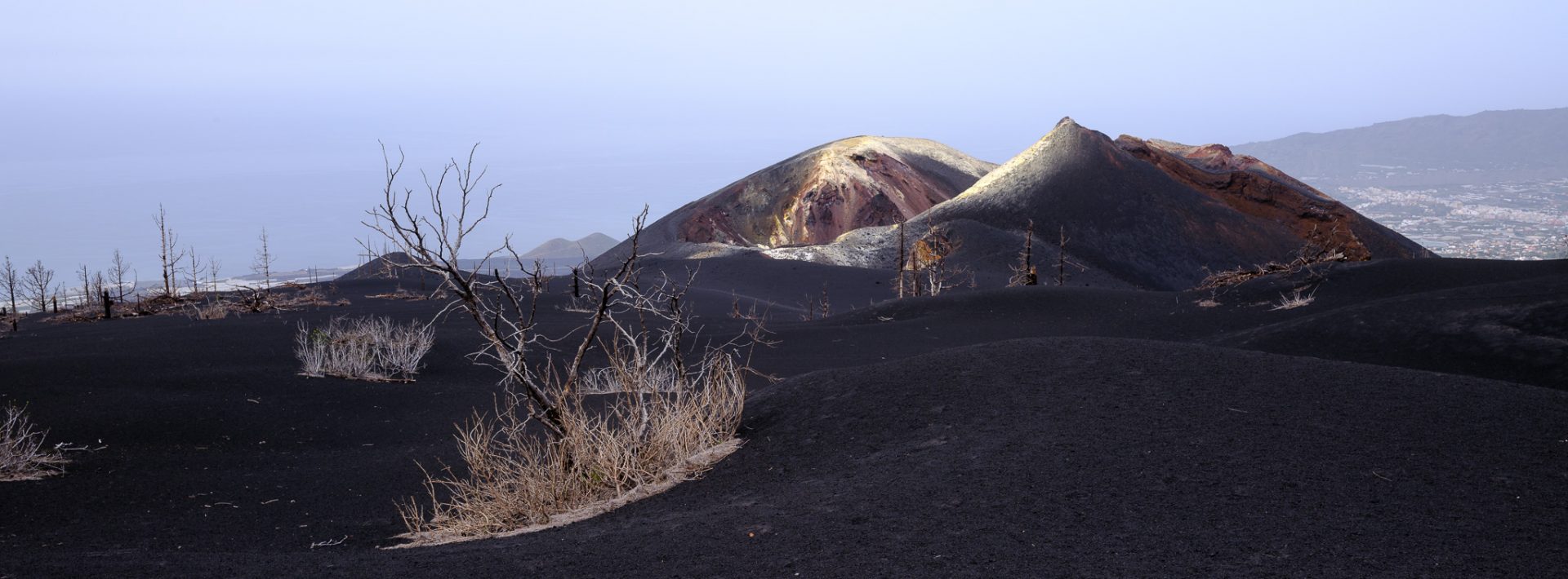
On September 19, 2021, the Cumbre Vieja volcano on La Palma erupted and didn’t stop for 85 days. It was the longest eruption on the island in recorded history. By the time it ended on December 13, lava flows had destroyed over 3,000 buildings and forced around 7,000 residents to evacuate. Nearly 1,200 hectares of land were buried under ash and lava, and the flows eventually reached the sea, literally creating new coastline. The eruption also produced an entirely new volcanic cone — now officially named Tajogaite — rising some 200 meters above the surrounding terrain. What was left behind is an eery and fascinating moon-like landscape.
You Can’t Just Show Up
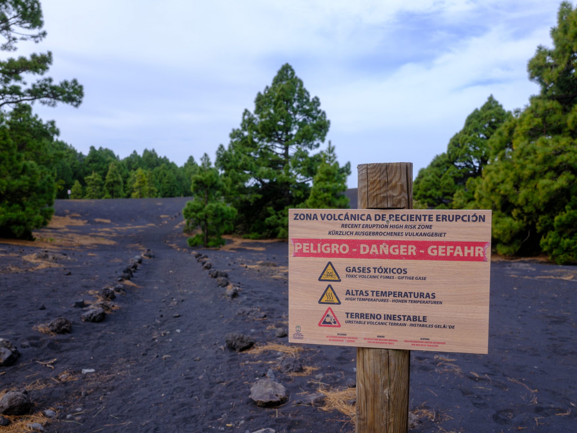
Let’s start with the logistics, because this isn’t a normal hike that you can do by yourself. The area around the Tajogaite crater is restricted access. You need to be part of a registered guided group, full stop. Gases seem to be still present, the terrain can be unstable in places and the local authorities are apparently giving nature an opportunity to recover. As a matter of fact, you have to stay on the marked trails the entire time.
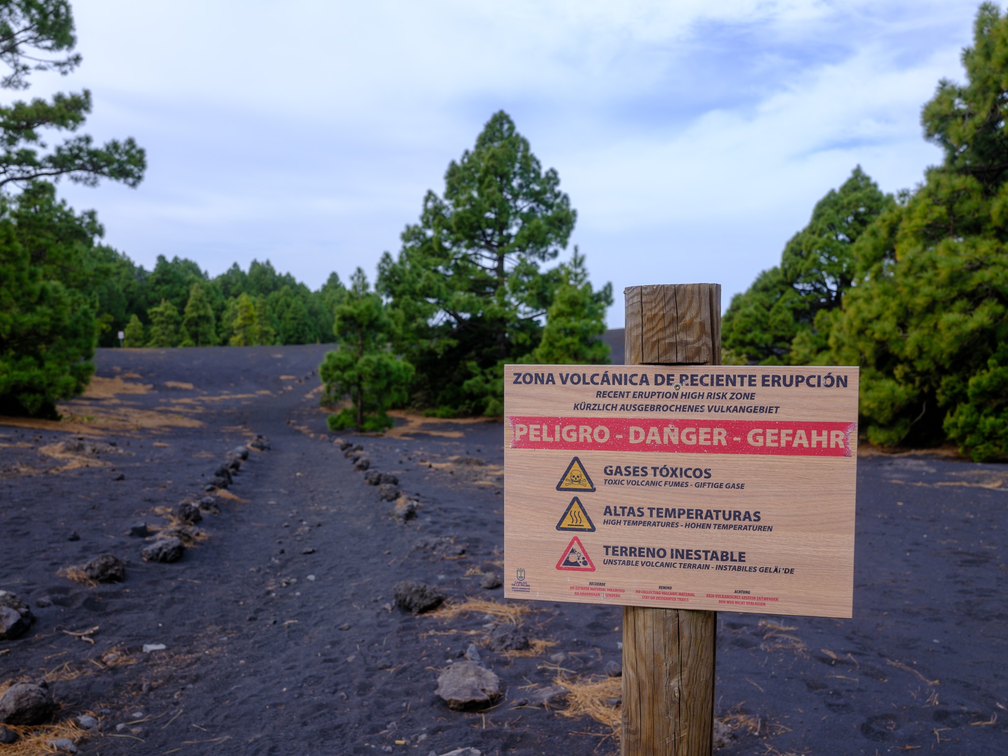
We went with La Palma Outdoor, based in Paso de Abajo. Highly, highly recommend. Our guide Steven was super fun and provided stories about the volcano and the island here and there.
The Hike Itself
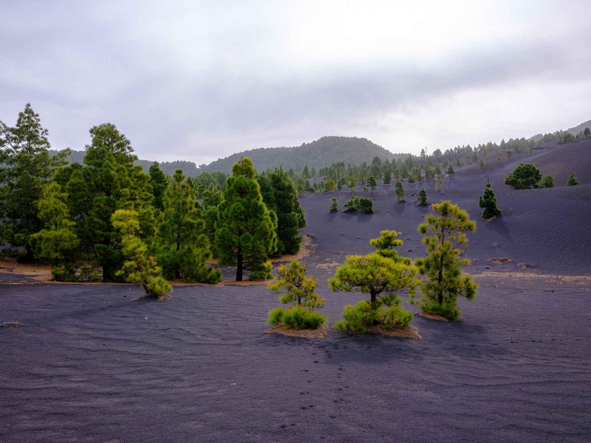
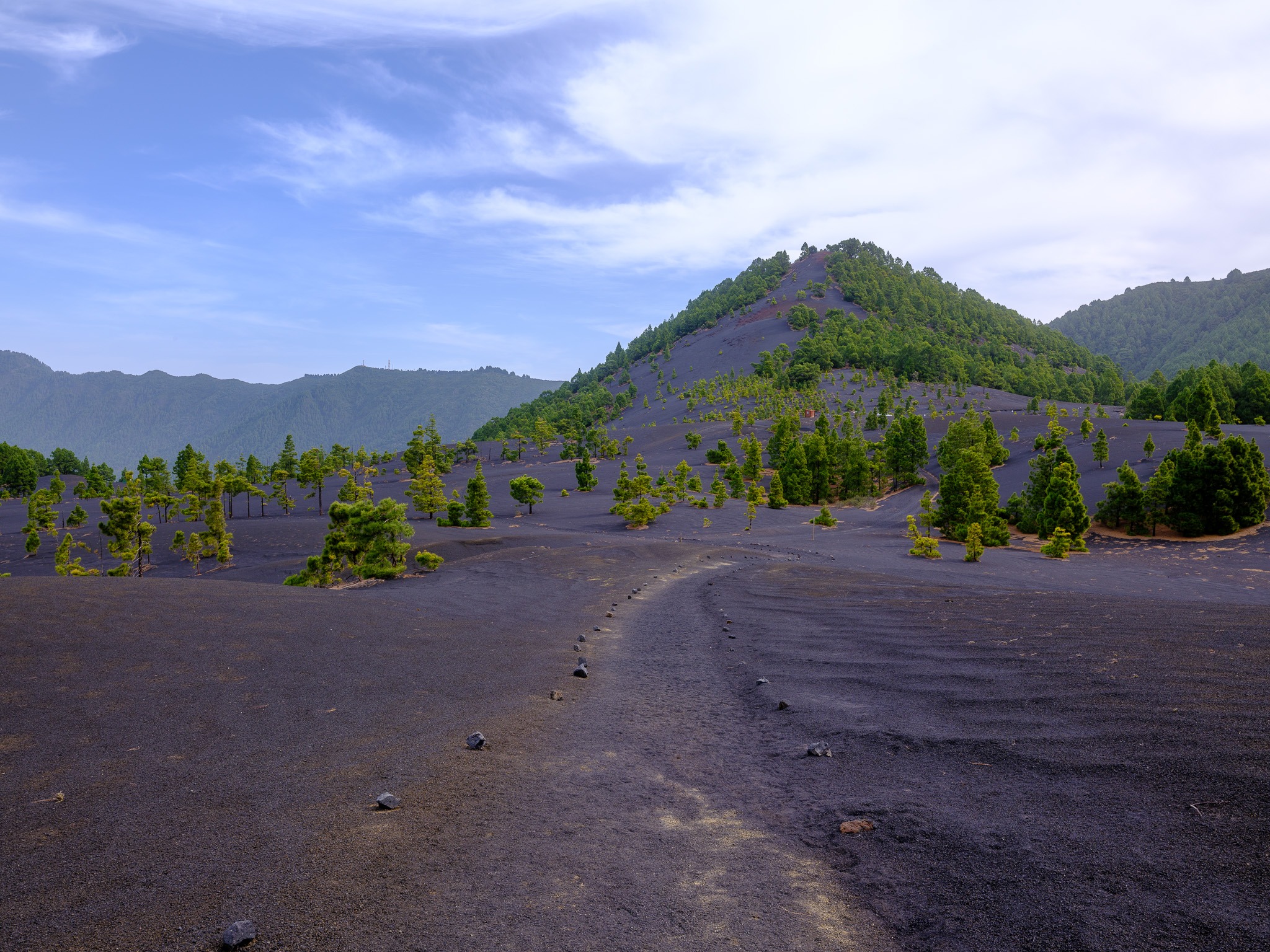
The route covers about 7.5 km with roughly 300m of elevation change. You start at around 1,300m, dip down to approximately 1,000m, and work your way back. Along the way, you notice that the landscape changes constantly. Sometimes within a few dozen meters. One moment you are walking in a small growth of fir trees, the next you are standing next to a number of dead tress.
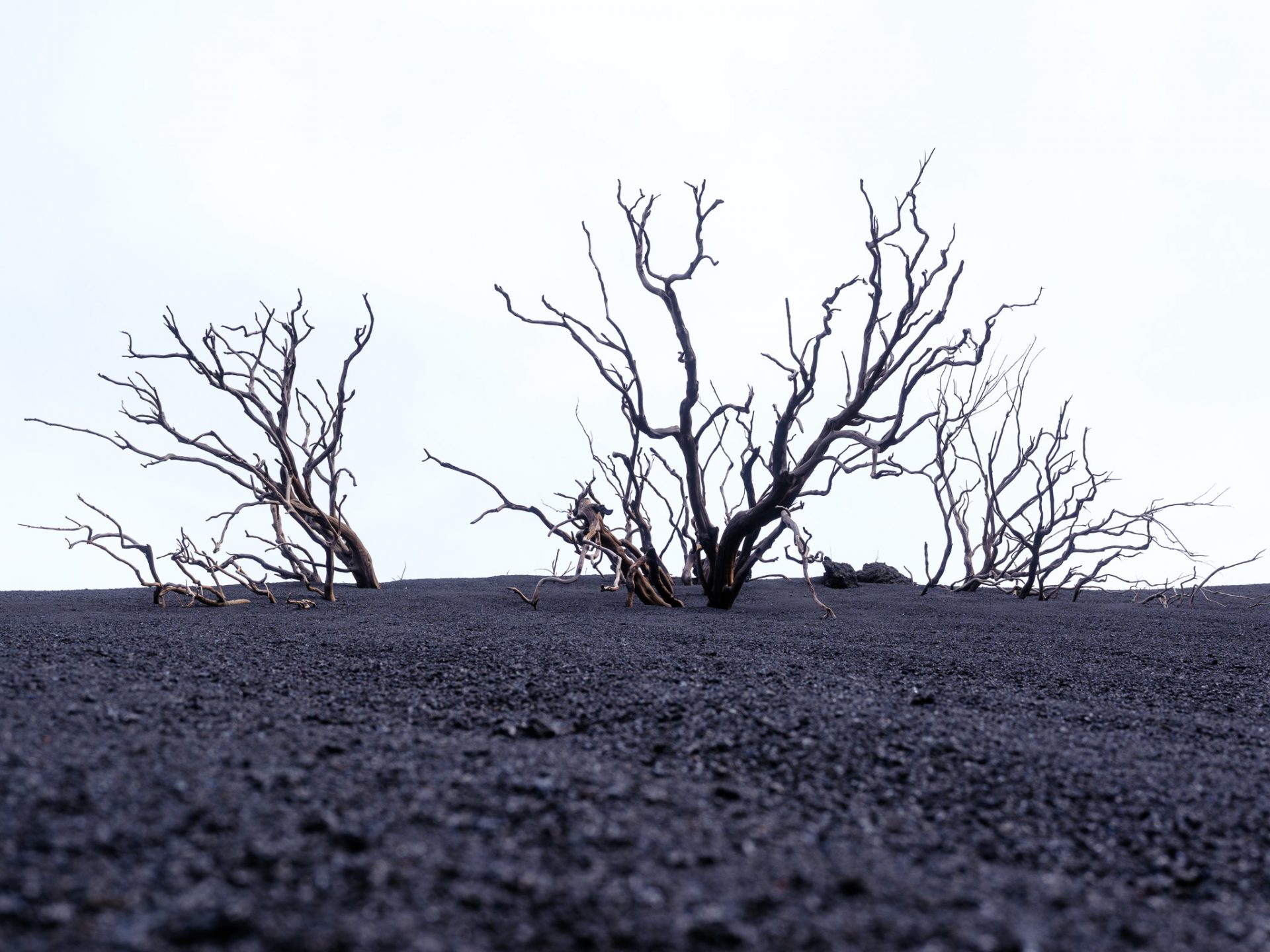
The one thing that does not change is the color of the ground: black. Deep, dense, grinding volcanic ash and debris underfoot, as far as you can see in every direction. The sound alone is worth the trip. There is a constant crunch and grind beneath every step. If you were to walk barefoot, you would probably have the softest feet after that.
A Landscape in Transition
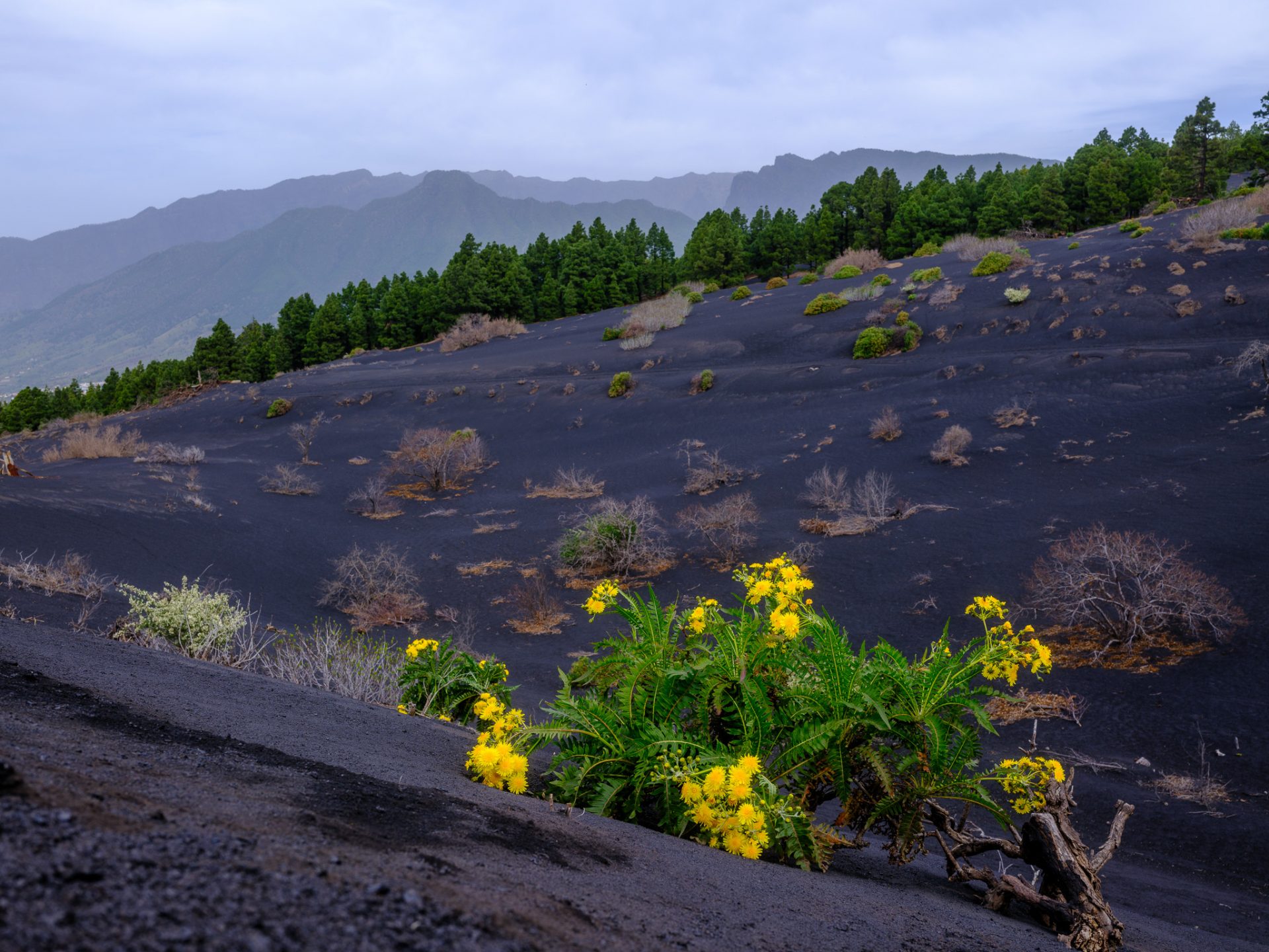
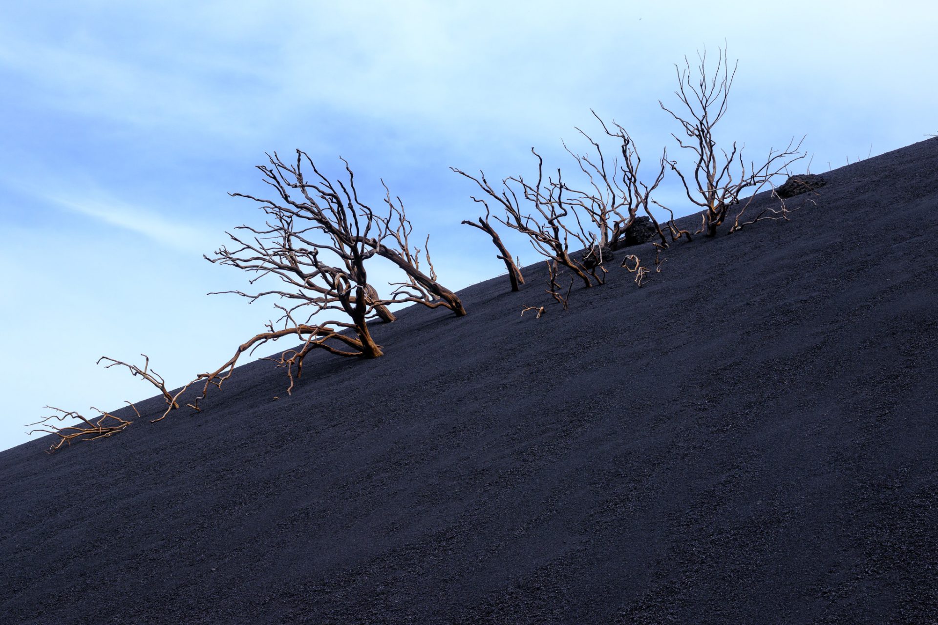
The opening stretch of the trail threads through green pine trees. A strange splash of life against the dark backdrop. Yellow and white flowers push up through the ash here and there. They almost feel like small detonations of color in an otherwise monochrome world. It’s amazing contrast (depending on the sunlight). Colors and structures can change any minute. Even little changes in sunlight have an impact on the vibrant colors. As a matter of fact, the black ash can seem pitch black one minute and then shimmer in a darkish blue the next.
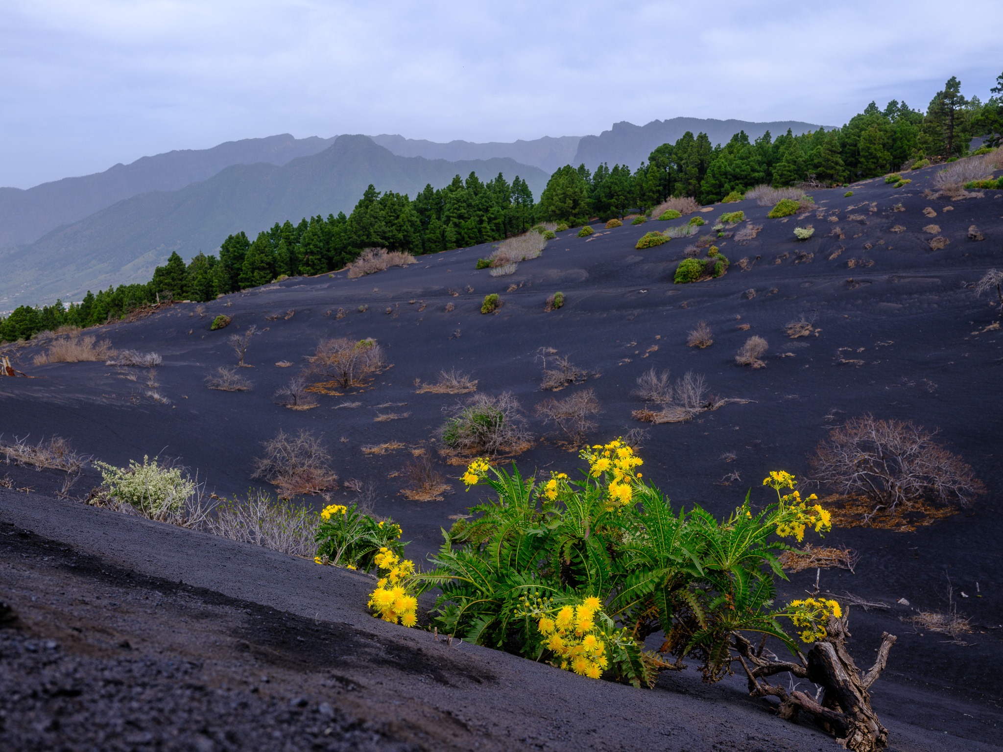
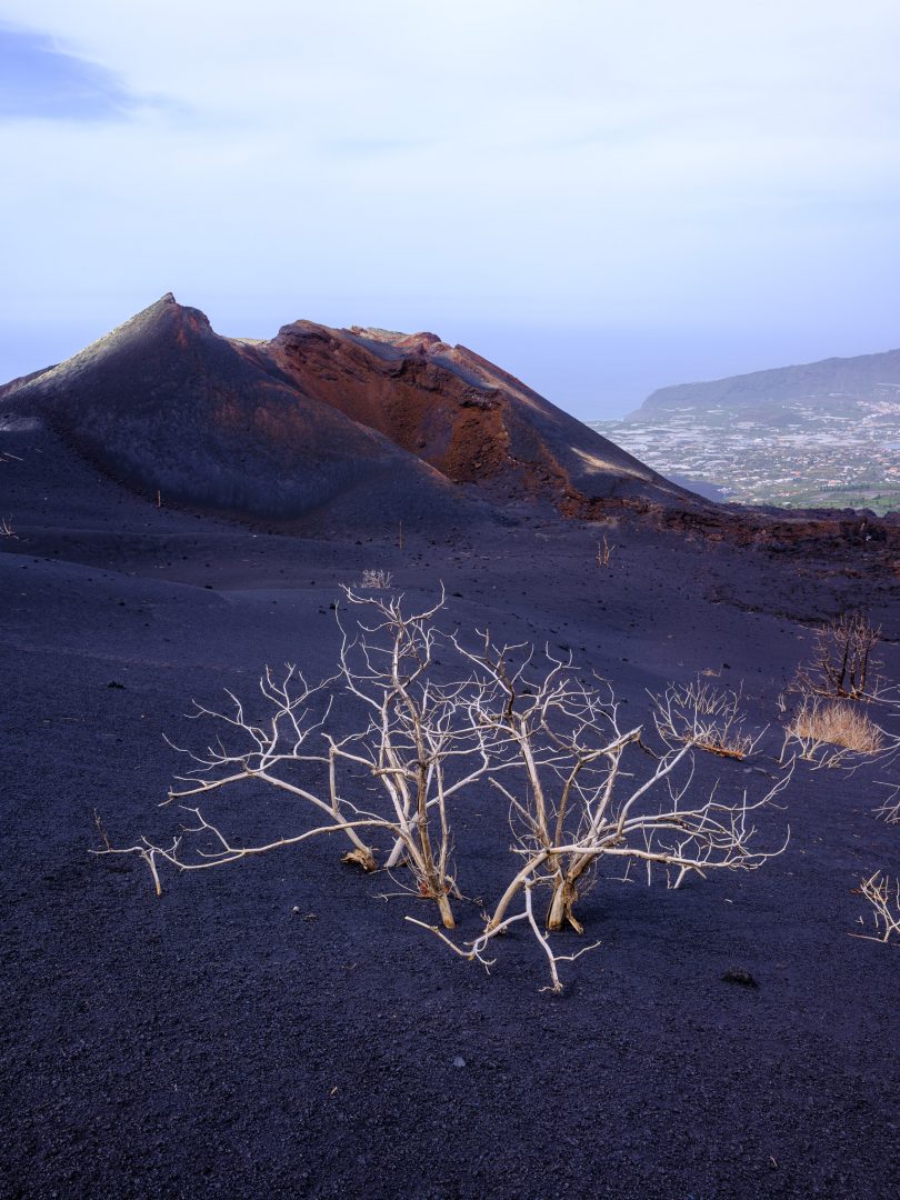
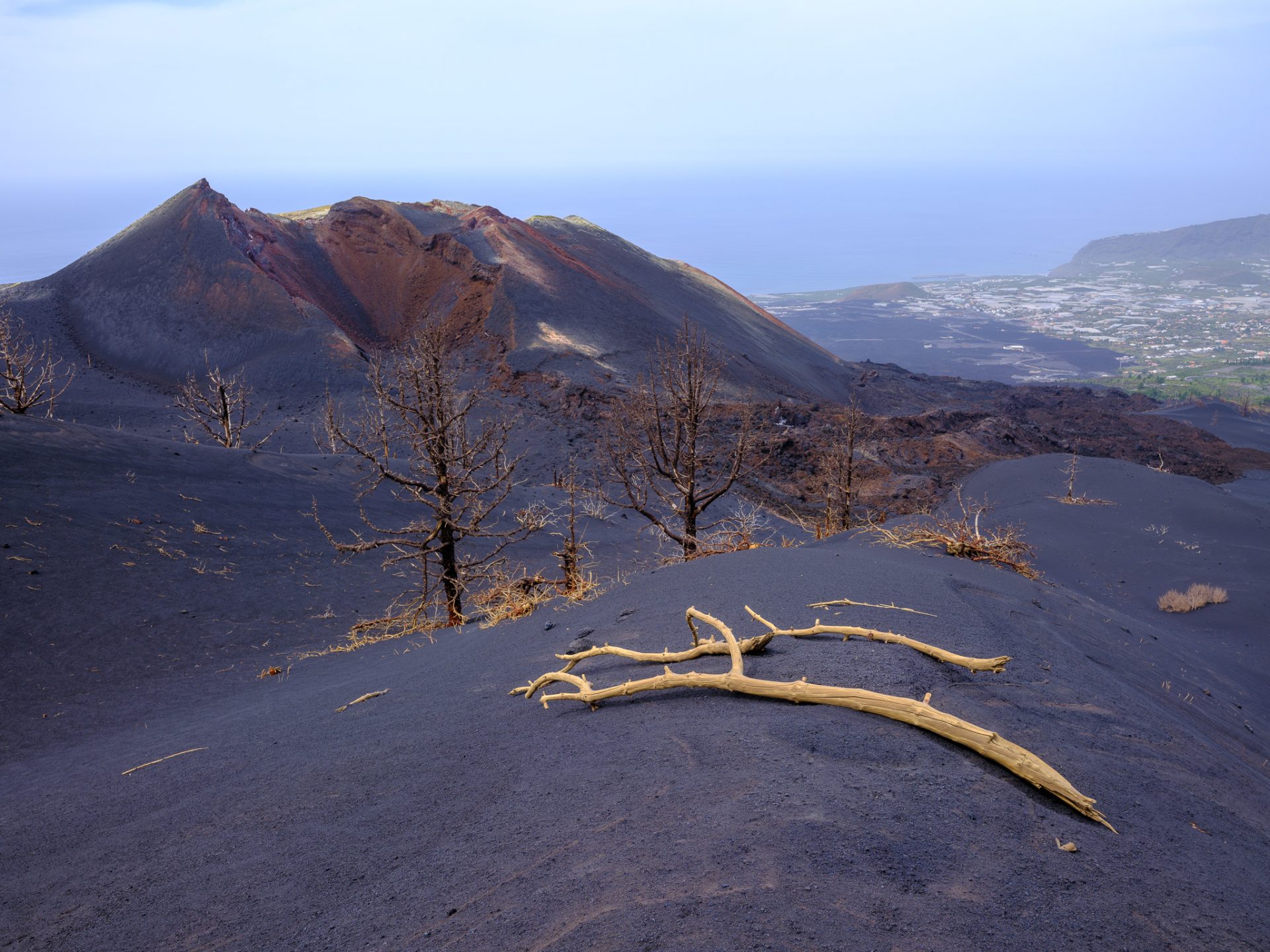
Then, gradually, you notice the dead trees.
Steven explained it: underground heat. The roots of these trees were essentially cooked from below. Now they stand around the landscape like some skeletal and frozen figures. But not all of them. Some are showing new growth. It’s remarkable to see how nature is able to adapt and to restore itself.

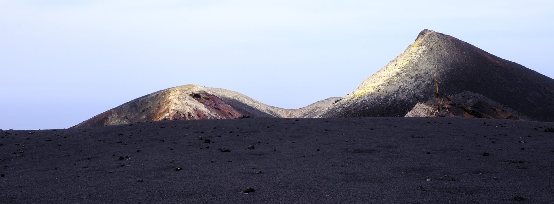
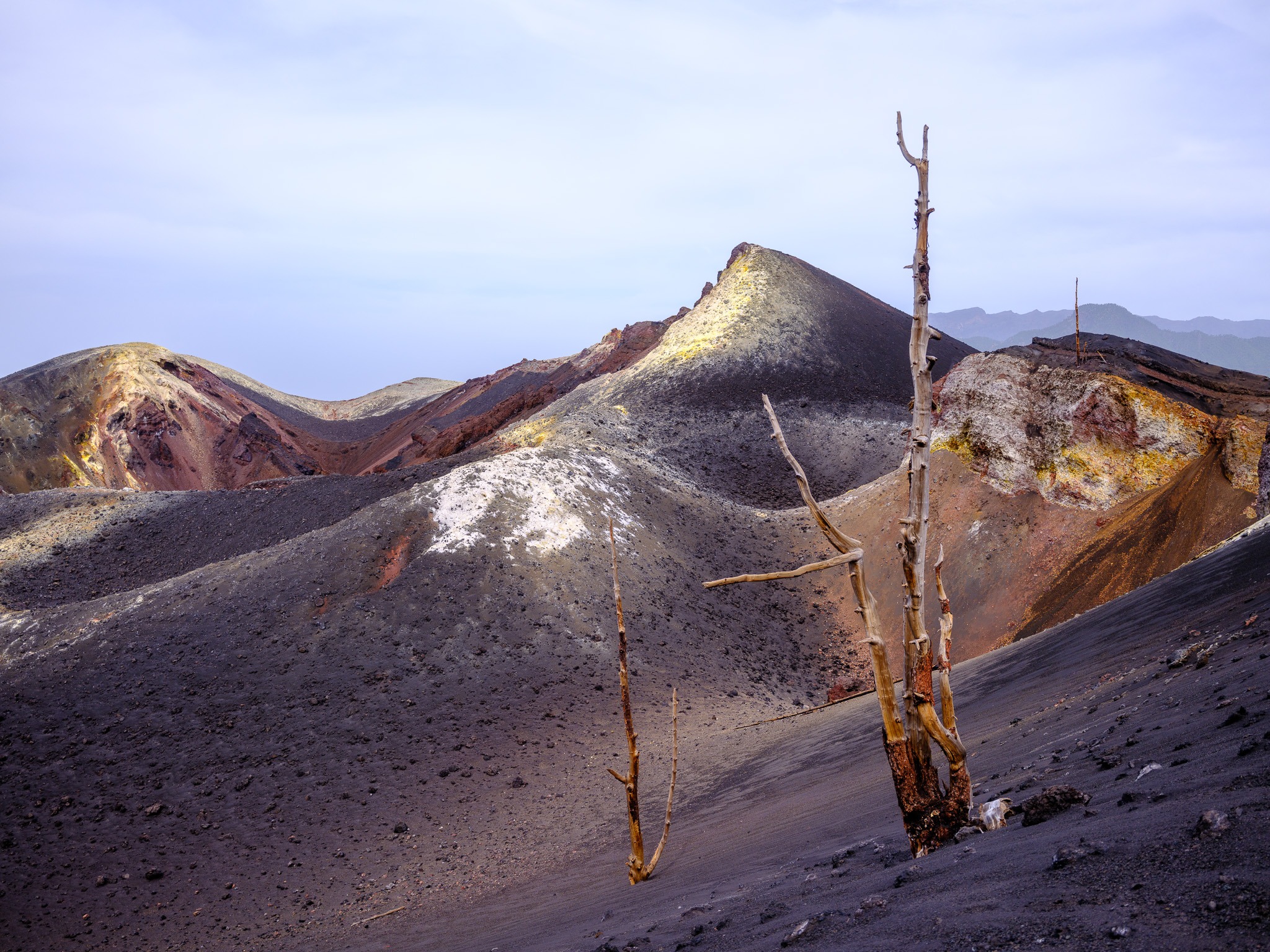
Further along the trail, you get your first real view of the crater complex — the set of cones formed during the 85 days the eruption ran from September to December 2021. It’s a strange thing to stand and look at something so recent. These aren’t ancient geological formations. These are craters younger than many smartphones.

Up close to one of the cones, the color palette shifts entirely. Forget the black. The sulfur and volcanic gases still gently venting from the earth paint the rock in vivid yellows, oranges, and deep reds. Strangely, we did not smell any sulfur that day (my Icelandic friend calls this: ‘salty-farty’).
On Camera
The Fuji GFX 100RF was the perfect photographic companion for this hike. Light, versatile and no need for lens-swaps (volcanic dust & sensors don’t go well together). The digital zoom gave me plenty flexibility. I also experimented with different aspect ratios throughout the hike, which helped match the framing to the drama of the landscape. Some scenes demanded wide. Others — the dead trees, the cone up close — called for something tighter and more intimate.
Summary of the day
Overall, a super hike and experience. If you have never seen a volcano up close, this is a must do when you are on the island. I have been lucky to experience a live volcano before and this is still super cool. Witnessing nature make a return after such a catastrophic event is simply amazing. Also, the colors and sounds are mysterious.
Is it an easy hike. Depends. I am fit and the 8km did not pose any problems for our group. But the volcanic material makes walking a tad more difficult. Also, it can get pretty hot out there. Make sure to bring plenty of water and food. Total walking time was 1:50h and 3hrs respectively with stops.
What will stay with me? Great memories. A few photos that I really like. And plenty of black volcanic dust that collected in my hiking shoes. No matter how frequently I shake them, there is always some dust left over.
If you go:
- Guide service: La Palma Outdoor, Paso de Abajo (verify current contact info before booking)
- Distance: ~7.5 km | Elevation change: ~300m | Start elevation: ~1,300m
- Guided groups only — independent access is not permitted